Neptune Pool Hike 2 August 2025

James Seymour and four other potential members of the Amajuba Section of the MCSA , namely Bill Scurr, Jacqueline , Michelle Luffingham and Sandy Fyvie embarked on the the Neptune Pools Hike from Cathedral Peak Hotel on Saturday the 2 August 2025.

This is a moderate day hike of some 10km with some 307m of elevation gain. The path is well maintained and signposted.

The views of the Mitre, Outer Horn, Mlambonja Pass and Mount Helga, especially from the ‘End of the Road’ lookout site were magnificent. The pools, despite the fact that it was Winter, were still relatively full and crystal clear. What an enjoyable day…with the stunning scenery of the Cathedral Peak area 🙂

James Seymour 19 August 2025

Mnweni Circuit 13 to 16 August 2025

Frikkie van Zyl and James Seymour, together with four potential new MCSA Amajuba Section members, namely Sean Jacklin, Shane Howard, Christel Janse van Rensberg and Tess Janse van Rensberg, embarked on the Mnweni Circuit trek on the 13th of August. The route we chose was to go up the Mnweni Pass and down the Rockeries Pass.
Day 1 involved catching a taxi from the Mnweni Cultural Centre to the start at the Mnweni River Bridge. We then trekked for just under 12km to Five Star Cave for our first overnight. The route on the first day was relatively easy with no significant challenges or obstacles.
The views of the Dassie, Outer Mnweni Needle and Fangs Pass were spectacular.


Day 2 involved ascending Mnweni Pass via Chi Chi Camp to Ledgers Cave. The first four kilometres or so were relatively straightforward, but the elevation was, however, steep. The final two kilometres of the pass were challenging due to relatively thick snow that covered part of the trail. It is recommended that members consider using short spike hiking crampons on this route when there is snow. There were sections not only with snow, but also with ice.


The views made up for this section, though :-), especially those of the Inner and Outer Mnweni Pinnacles.


We then made our way to Ledger’s Cave. The approach to this cave has severe exposure and is only recommended for those with a serious head for heights. Two members of our party opted to camp on the escarpment. I suggest that any party using this cave consider laying a vertical and horizontal temporary rope handrail to prevent potential falls of a few hundred metres. The views from this cave are exceptional, though.


Day 3 was a very leisurely one; we hiked just over two kilometres to Mponjwane Cave. We encountered thick snow, which made these two kilometres feel a lot longer than it was. It was tough going towards the end. As always, Mponjwane blessed us with magnificent scenery.


Day 4 involved the 12km down Rockeries Pass to the pick-up point at Hlongwane’s Kraal. The hike down from Mponjwane Cave to the pass again was challenging as a result of the snow. Again, hiking crampons would have made this exercise safer.


We were all relieved that there was no snow in Rockeries Pass and were astounded by the spectacular Rockeries ‘pinnacles or pipes’ . The path down to the ‘waterfall’ is obvious, with wide zig zags. It is very ‘scree’ like and thus slippery. It is best to slowly and cautiously descend here.


The path around Nguza Camp is more challenging. Two routes are traditionally used. The one encircles the base of the campsite area, and the other traverses the campsite with a cliff at the end. Both routes require significant scrambling, and ideally, the placement of temporary handrails and the dropping of packs. The circumvension route was chosen, which proved to be a regrettable mistake. A large section of this path has been eroded, and now has a steep sand embankment, which seemed easy to overcome but proved to be a dangerous challenge. This route should now be avoided, and the other route, which was always the more challenging, should be used.


The rest of the route was relatively easy going, except for the last ridge area before the Mnweni River. This section is badly eroded and ‘scree-like’ and needs to be descended very cautiously. We opted to follow the traditional river route, rather than the ridge route, which is used when the Mnweni is flowing strongly in summer.


We happily arrived at Hlongwane Kraal at 13h00, and dished out our remaining food supplies to very grateful local children: wonderful memories, stunning scenery and some hard lessons learnt.

James Seymour 18 August 2025

Mullerspas na Normandienpas hike (20-21 Desember 2014)

(Bydrae deur: Ruan Adendorff) 

Op ‘n vroëe Saterdag oggend het 4 van ons (ek, Gerhard, Richard en Thea), weggespring van Mullerspas se uitkykpunt vol moed vir ‘n heerlike avontuur. ‘n Ligte berg briesie het ons koel gehou teen die eerte bult, wat sommer die inleiding was tot nog vele uitdagings.

Na ongeveer ’n uur se stap was ons op en oor die berg en het ons begin afsak na die spruit wat gelyk het soos die hek tot die boskloof.

Dit was nogal ‘n verassing vir sekere van die hikers, want dit was niks anders as “bundu bashing” en kranse nie. Gelukkig het Gerhard sy tou saam gebring want die hike het verander na ‘n klas 5 hike. Deur die bos met sy dorings moes ons kruip, abseil op twee plekke en soos ’n bosbok die skuinstes aan durf, net om onder te kom.

Dis wel die moeite werd met die mooi natuurskoon, die voëls wat sing, die sonbesies wat gons en die vars klam reuk van die bos. Dis mos wat ’n mens se batterye weer laai! Op een stadium het Thea mis getrap en verskuif na ‘n posisie wat 1.5 m laer as die res van ons was. Gelukkig het sy nie verder beweeg nie, anders sou sy oor ’n baie erg skuinste geval het. Ons het ons toe soos ‘n klomp Alpine bergklimers met tou aan mekaar vas gemaak en die pad verder aan gedurf. Na ongeveer 4 ure het ons 100m gedaal en toe middag ete geniet langs die rivier met sy massiewe rotse.

Met nuwe krag het ons die volgende steilte aangepak na nog ‘n rivier kruising. Aan die bokant het Union sy verskyning gemaak en nuwe moed in ons moeë lywe ingeblaas. Aan die voet van die bult het ons vars drinkwater gekry en ‘n goeie plek om te kamp vir die aand. Dis toe dat Gerhard ontdek het dat hy die binne gedeelte van sy tent by die huis vergeet het!

Daardie aand is daar heerlik saam gekuier soos net in die berge gedoen kan word. Die mis het later stadig in gerol en ons bedek vir die nag. Die volgende oggend het Gerhard uit sy tent geloer met ‘n buff oor sy gesig. ”Ek het heel nag gogga’s geëet, yummy!” Was sy woorde. Richard en Thea het geruk in hulle tent soos hulle lag en ek self kon ook skaars my lag hou.

Dag 2 was die pad nie heeltemal bekend nie, maar die mis het darem opgeklaar en ons kon min of meer sien waarheen ons op pad was. Die terrein was aansienlik better, meer plat en met ‘n pragtige uitsig oor die Normandien area. Teen 12:00 het ons die eindbestemming bereik en gewag vir ons ry geleentheid.

Dit was ‘n stewige hike, maar die moeite werd! Dankie aan almal wat dit mee gemaak het.

Moorfield hike – 2017.04.22-23

(Contributed by: Len Stoop) 

On Saturday morning we met at Game at 07:30. We waited a while for more people, but after a while we left for the farm Moorfield. This farm is situated at the top of Mullers pass, ±25 km from Newcastle.

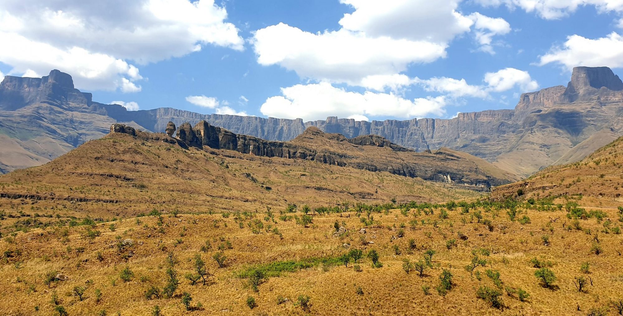
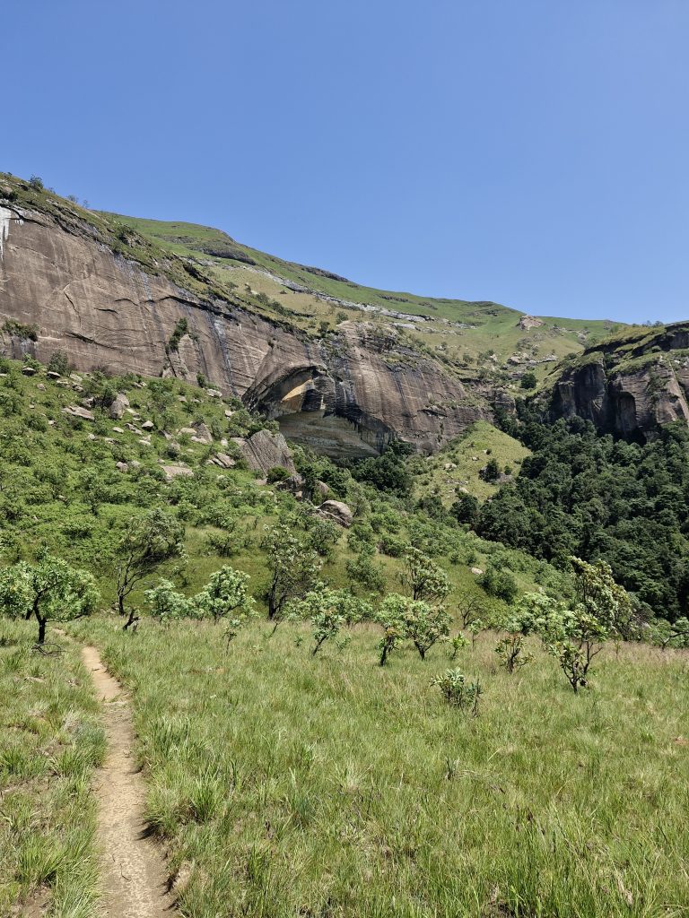
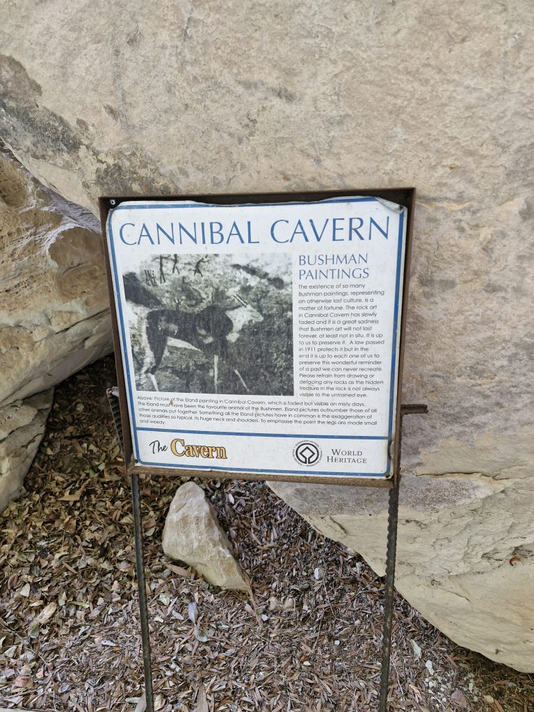
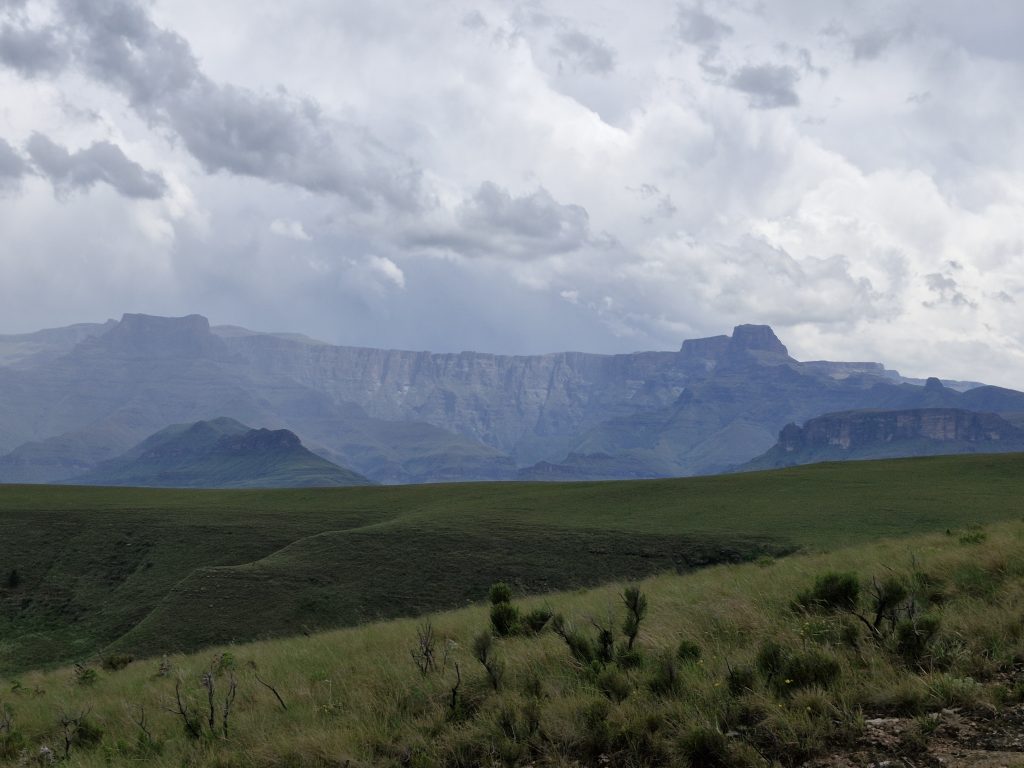
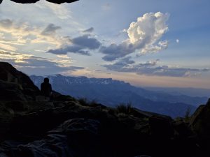
The main trail starts there and carries on into the adjacent Ncandu Forest reserve, which is supposed to be managed by the Ezemvelo KZN Wildlife (the old Natal Parks board).

There is the main 2 day trail that takes a person to the 2 overnight huts, then into the gorge through the indigenous Ulumbe forests and back to Moorfield. Then there are various other day hikes to waterfalls, into the side gorge, through forest and around the top of the mountain. The road is quite bad, especially the last part leading from the main road to the farm house (luckily my old Nissan made it!).

When we arrived at the farm house, we paid our dues to Deon de Waal, the new manager. The new owners, Thomas & Sonnya Holtz were in Johannesburg at the time. They would like to create a greater nature reserve in the area with the help of neighbouring farmers, Ezemvelo and work that botanical and wildlife researchers are doing in the area, etc. New accommodation, new ablution and kitchen facilities for day visitors and campers have been built.

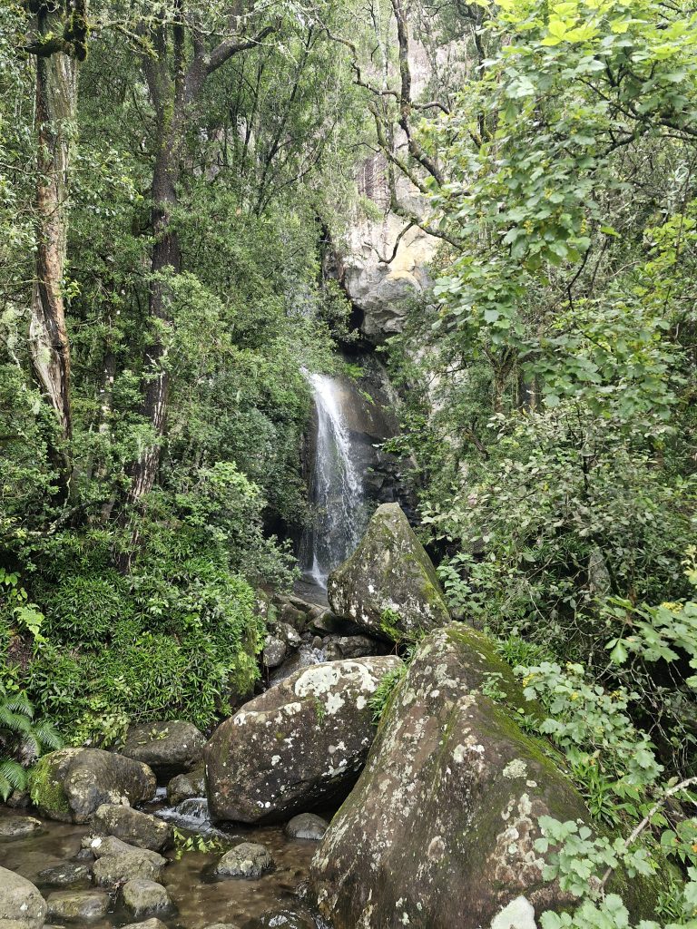
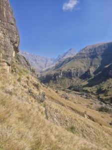
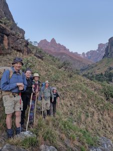
It was a clear and sunny day. Henry and the 2 young men were going to arrive a bit later, so we made some coffee and waited for them. We decided to walk to the small waterfall and pool close to the house, then along the top of the eastern side of the gorge. I decided to return to the farm house and wait for Henry & co. Gerhard, Maria and Lulu carried on. A bit later, Deon followed Gerhard & co., to show them the absail anchors and the path to the bottom of the high waterfall. Henry & co. arrived at about 11am, because they missed the Mullers pass turn-off. They eventually went up Normandien pass and through the Freestate to Moorfield.

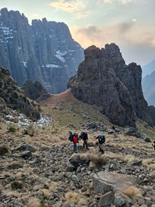
Henry, the 2 boys and I took a walk along the top of the eastern side of the gorge, looking for Gerhard & co. Later we returned to the farmhouse, where we had lunch. Gerhard and Maria brought their abseiling equipment along and they suggested that we go absailing after lunch. Gerhard wanted to fetch Lulu’s shoes and their walking sticks, that they left on the path to the bottom of the waterfall. I went with Gerhard, who was walking in front. We hardly left the farmhouse when Gerhard jumped backwards, shouting “SNAKE!!”. There was a spitting cobra in the grass next to the path. Well, after we let the snake sail off, we retrieved the shoes and sticks and then returned to the others.

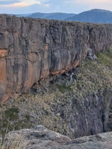
Later we all went to the anchor points, where Gerhard and Maria set up the equipment and gave a lesson to the rest of us. Eventually Maria, Marc, Henry, Gerhard and Lulu (strapped to Gerhard), abseiled down a vertical, 25m high cliff.

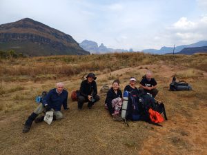
After all that excitement, we returned to the farmhouse. Soon afterwards, Gerhard, Maria and Lulu returned to Newcastle. The rest of us pitched our tents, made a camp fire and then had a nice braai.

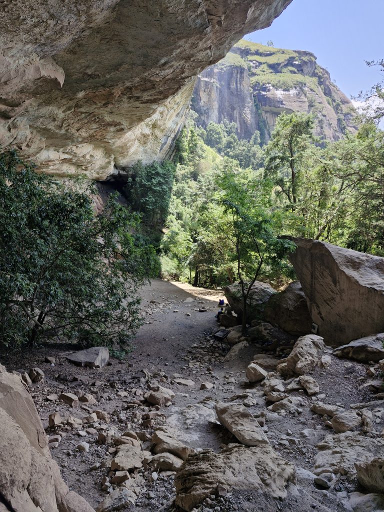
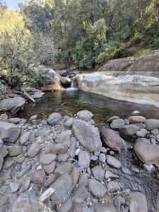
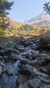
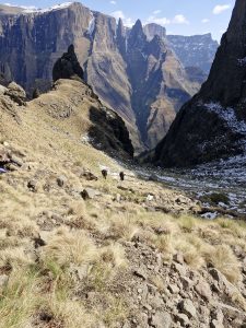
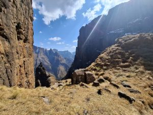
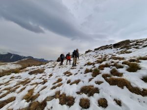
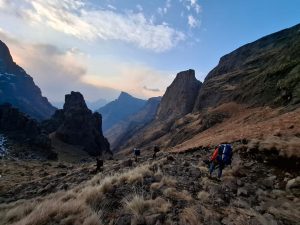
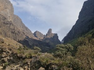
On Sunday morning, while we folded up our tents, Tjaart and Marianne arrived. We took a walk to the upstream waterfall, round the hill to the top of the waterfall and then back to the farmhouse. From here, we walked the same path as on Saturday, but this time into the gorge, where the path leads to the bottom of the high waterfall. We did not climb all the way down, but followed the path through the indigenous forest, to the top of the high
waterfall. While we negotiated some boulders, I slipped on a muddy spot and fell backwards into a small puddle. Needless to say, I was very wet and muddy, with a painful calf muscle.

Henry and the boys decided to leave us there and return to Newcastle, because Benjamin did not feel well. Tjaart, Marianne and I had lunch at the waterfall, while I tried to dry myself in the sun.

I planned to walk along the western side of the gorge after lunch, but because of my injury, Tjaart and Marianne recommended that we don’t, so we returned to the farmhouse, packed up and returned to Newcastle.

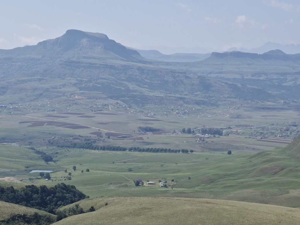
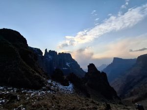
To summarise, we did not walk to all the spots that were planned, but it was still quite eventful and enjoyable. This area is the most beautiful in the Newcastle area, especially in summer when all the streams are running. The trial needs some work, but we should go there for a 3 day excursion.